Ads By Google
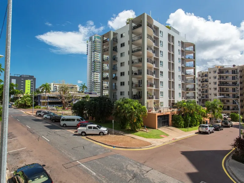
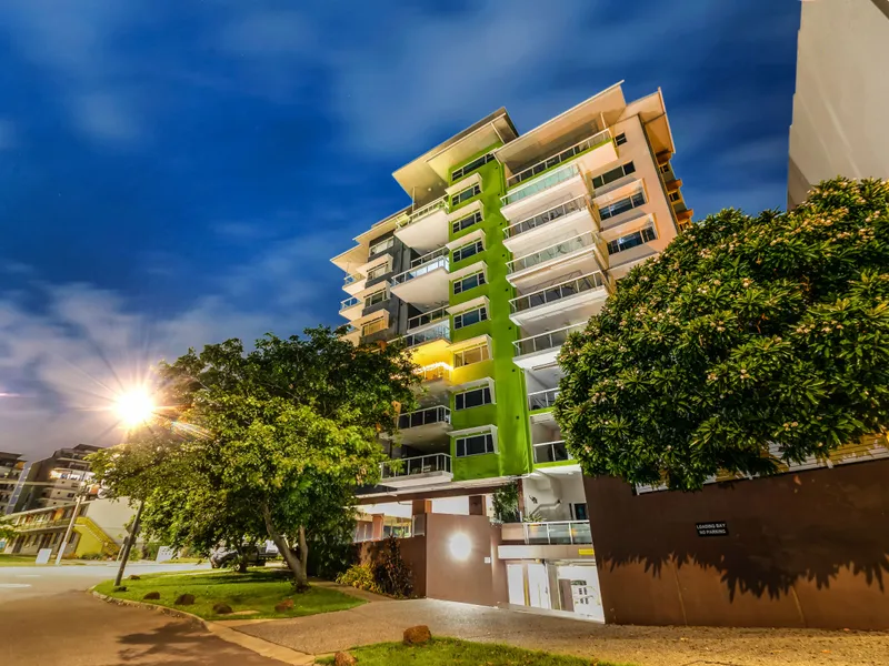
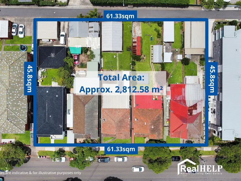
Significant land size of 2,812.58 sqm (approximately)<br/>Prime location<br/>R4 High-Density Zoning <br/>Huge Potential in the Near Future<br/><br/>RealHelp Real Estate is proud to present an admiringly sought-after inner west, high-density development opportunity (STCA*).<br/><br/>Situated at 26, 28, 30, 32, 34 & 36 Wonga St Canterbury, this opportunity gives forthcoming investors the opportunity to reserve one of the best R4 high-density land holdings over a combined 2,812.58 m² (approximately). <br/> <br/>A developer's dream in respect to the high-demand marketplace and an end purchaser's dream given the exclusive family-orientated lifestyle location on the doorstep of a host of local amenities. <br/><br/>An incredibly rare opportunity with excellent future revenues achievable. The government has planned so many major infrastructural developments for Canterbury. This is obvious that once these planned projects are completed, this will become a gold mine for those investors who are forward thinkers and taking action now<br/><br/>Developer's Info:<br/><br/>-Significant landholding of 2,812.58 sqm (approximately)<br/>-Zoned R4 High Density<br/>-Floor space ratio – 0.9:1<br/>-Permissible height – 11.5m<br/>-Very Wide Frontage - 61.33 m (approximately)<br/>-Depth - 45.8 m (approximately)<br/><br/>This potential development site is located in a well-established and prime location. Some of the highlights are as below<br/><br/>Transports:<br/>Bus stops are within walking distance<br/>Canterbury train station 950m<br/>Campsie train station 950m<br/>Hospital and Medical Centres:<br/>Canterbury Hospital 1.8 km<br/>Campsie medical and Dental 1.1 km<br/>Primary Schools:<br/>St Mel's Catholic Primary School (Catholic) 0.50km<br/>Campsie Public School (Government) 0.59km<br/>Canterbury South Public School (Government) 0.85km<br/>Canterbury Public School (Government) 1.10km<br/>Harcourt Public School (Government) 1.47km<br/><br/>Secondary Schools:<br/>Canterbury Girls High School (Government) 1.15km<br/>Canterbury Boys High School (Government) 1.40km<br/>Edgeware School Combined (Government) 2.02km<br/>Trinity Grammar School Combined (Independent) 2.32km<br/>Belmore Boys High School (Government) 2.46km<br/><br/>Child Care:<br/>Within a kilometer, there are 4 child care centers<br/><br/>Permitted Development:<br/><br/>Permitted without consent:<br/>Home occupations<br/><br/>Permitted with consent:<br/>Attached dwellings; <br/>Bed and breakfast accommodation; <br/>Boarding houses; <br/>Building identification signs; <br/>Business identification signs; <br/>Business premises; <br/>Car parks; <br/>Center-based child care facilities; <br/>Community facilities; <br/>Dual occupancies; <br/>Dwelling houses; <br/>Environmental protection works; <br/>Exhibition homes; <br/>Flood mitigation works; <br/>Home-based child care; <br/>Home businesses; <br/>Hostels; <br/>Multi-dwelling housing; <br/>Neighborhood shops; <br/>Office premises; <br/>Oyster aquaculture; <br/>Places of public worship; <br/>Recreation areas; <br/>Residential flat buildings; <br/>Respite daycare centers; <br/>Restaurants or cafes; <br/>Roads; <br/>Semi-detached dwellings; <br/>Serviced apartments; <br/>Shop top housing; <br/>Shops<br/><br/>Why You Should Invest in Canterbury?<br/><br/>Latest DCP can be found here https://www.cbcity.nsw.gov.au/development/planning-control-policies<br/><br/>Canterbury Station Upgrades:<br/><br/>Customers at Canterbury Station will have a new air-conditioned metro train every four minutes in the peak – that’s 15 trains an hour. Canterbury Station is currently serviced by four trains an hour in the morning peak.<br/>The station will be upgraded with new lifts for the first time, level access between platforms and trains, and platform screen doors to keep people and objects away from the tracks.<br/><br/>A Station Design and Precinct Plan (SDPP) has been prepared for Canterbury Station that shows how the new station design has developed and how it will integrate with the surrounding precinct. <br/><br/>Canterbury Town Centre Upgrade Stage 2:<br/><br/>As part of the 2020/21 Capital Works Plan, the Canterbury Town Centre Stage two upgrade worth $8.9M has commenced.<br/><br/>Overview of Project<br/><br/>The project includes:<br/>Realignment of Canterbury Road, Close Street, and Charles Street intersection to facilitate new traffic signals<br/>A slip lane from northbound Canterbury Road to Charles Street for safer turning from Canterbury Road onto Charles St<br/>Construction of dedicated right-hand turning lane from southbound Canterbury Road to Charles Street, a left turning lane from Close Street to Canterbury Road, and a right turning lane from Charles Street to Canterbury Road to allow safer right hand turning from Canterbury Road to Charles Street<br/>New streetlights and paved footpaths for the safety of pedestrians<br/>Undergrounding of overhead power lines<br/>Upgrade of the Canterbury Road shared path underpass which falls along the Cooks River cycleway, this includes lowering and widening the path and installing lights. Adding convenience and increased foot and bike capacity to the shared path.<br/><br/>With the Canterbury Town Centre stage two upgrade, it’s about bringing new energy and excitement to Canterbury, and transforming it into a commercial, social and cultural heart of the City.<br/><br/>The intersection upgrades will make turning at the intersection safer for vehicles and crossing the road easier for pedestrians.<br/><br/>The shared path underpass upgrade will improve accessibility and safety for pedestrians and cyclists using the Cooks River cycleway. The upgrade will provide greater clearance from the bridge and ample space for pedestrians and cyclists to use the path at the same time.<br/><br/>Planned Precinct:<br/><br/>Canterbury was announced as a Planned Precinct by the NSW Government as part of a housing affordability package on 1 June 2017. Planning for these Precincts is coordinated by state and local governments, helping ensure infrastructure such as schools, parks, community facilities, public transport and road upgrades is delivered to support community needs.<br/> <br/>Master planning for this Precinct will start shortly and will:<br/>build on the precinct plans developed as part of the Sydenham to Bankstown Urban Renewal Corridor Strategy<br/>involve more detailed studies and community consultation<br/>result in the rezoning of the precinct.<br/><br/>Planning for Schools: The Department of Education will identify locations for new or expanded schools within the corridor based on the growth proposed in the Strategy<br/><br/>Canterbury Road Review: A review of planning controls along Canterbury Road has commenced and is expected to be concluded this year.<br/><br/>Priority Precinct Rezoning: Canterbury Station Precinct has been identified as a Priority Precinct. DP&E will work with Council to prepare a master plan to support rezoning of the area including Canterbury Racecourse.<br/><br/>Special Infrastructure Contribution: DP&E is preparing a draft Special Infrastructure Contribution plan (SIC) to identify the regional infrastructure improvements required to support growth in the Corridor. The SIC levy will fund a range of community, transport, and open space infrastructure.<br/><br/><br/>Disclaimer: Whilst care has been taken in the preparation of this content, the particulars are not to be construed as containing any representation of the facts upon which any interested party is entitled to rely. All interested parties should make their own inquiries. All land measurements are approximate and Not accurate. The purchaser needs to conduct their own due diligence to get accurate information and must not rely on the information given in this advertisement.
Ads By Google